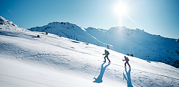
Itinerary n°5 Le Côpa
Work is being carried out on the drinking water reservoirs at Mase in the Tsa Creta sector. This will affect the Rando Parc itineraries starting from Mase.
It is best to start from Nax and Vernamiège. If you really want to leave from Mase, take the uphill path for the descent.
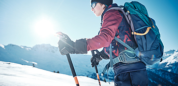
The Movement Tracks may only be used by people with the required technique, physical condition and equipment for ski touring, including emergency equipment (avalanche transceiver, shovel, probe). Please stay on the marked routes to avoid the danger of avalanches.
Each hiker ascends and descends at his/her own risk and responsibility. All hikers are subject to the FIS rules and must follow the SKUS guidelines (Swiss Commission for the Prevention of Accidents on Snow Sports Slopes).
The slopes and downhill runs are closed outside of opening hours and may not be used. Grooming machines with traction cables - danger of death! Only the resort and the persons responsible for the safety of the lifts and groomers may open the slopes and downhill runs to ski tourers.
The Nax Region Tourist Office declines all responsibility in the event of an accident. Please follow the safety instructions.
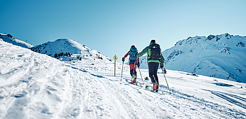
The "Le Côpa" itinerary starts at the Tsa-Crêta car park. You will have to go up by the forest road for 20m and then take the snowshoe way 3 and 3b. At a crossroads (alt 1758m) between several roads and paths, follow the path that goes north. Be careful, you will not have to follow route 7 towards La Combe. This is the return route of snowshoe trails 3-3a-3b. Follow this route until you reach the crossroads at the altitude of 1837m. Go up by the road (which you will take when you come back down) for about 150m. Leave this road to take a road on the right. This way passes through the place called "Le Côpa" and leads you to Pralovin. At the first stone chalet, leave the road to take a way on the right. You will reach the itinerary 4, which must be followed along the route that goes around a quiet area to the north. Be careful, an uphill track may leave in the direction of the quiet zone: do not follow it ! Through a magnificent larch forest join the crossroads of ways at the 2050 point. At this point leave the way to cross the ski slope. Go slightly uphill towards a flat area and pass near a large larch tree to cross the forest (slight downhill) then flat across a clearing facing east towards the Chiesso.
Downhill :
Go down by the track (road) which joins the great Planards track. at the place called "Par des Troncs". At this point, take the road that goes west to the point 1934m, then south, under the Pralovin mountain pasture. At the intersection (1837m) continue straight ahead and follow the road (very flat). Do not follow the road sign "Mase" but continue towards the old road. Turn left and follow the road that leads in 3 pins to the car park.